Why Nigeria’s Best Offshore Decisions Start With a Geochemical Survey
The expensive mistakes in offshore exploration rarely happen during drilling. They happen earlier, when a well location is picked on incomplete information, often before a geochemical survey that Nigerian operators could have relied on was even commissioned.
Every exploration program starts with a set of assumptions. Where should the first well go? Is the geological model right? Has the petroleum system actually been active here, or does the seismic just look promising? These are the questions behind the rise of geochemical survey Nigeria services, where operators pull chemical evidence from the seabed to back up what the geology seems to be telling them before spending real money to find out.
For companies working in the Gulf of Guinea, that means bringing in an oil and gas survey company in Nigeria that can fold several survey types into one decision-making process. Geochemistry doesn’t replace seismic or geotechnical work; it fills the gap those methods can’t reach alone.
What Seismic Alone Can’t Tell You
Seismic surveys are still one of the best tools for mapping subsurface structures, faults, and traps. But two prospects can look nearly identical on a seismic profile, and only one might hold commercial hydrocarbons.
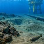
Geochemical surveys work differently. Instead of imaging structures underground, they analyse the chemical makeup of seabed sediments and water samples, looking for faint traces left by hydrocarbons that migrated upward over thousands or millions of years. Finding those traces is one of the more direct ways to confirm a petroleum system was actually active, not just theoretically possible.
How a Geochemical Survey Actually Runs
Collecting samples is the visible part. The planning and equipment behind it are where the value gets built.
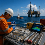
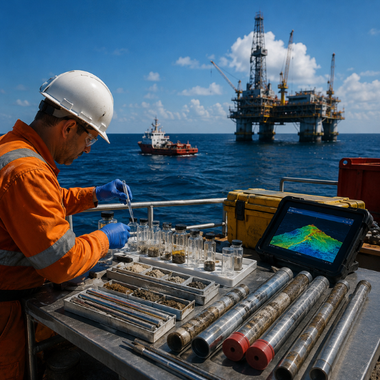
GEMS runs both macro-seepage and micro-seepage surveys, using its own CC-5000 geochemical core control system to recover cores safely, deployed from DP1 vessels with hydraulic A-frames rated to 5,000 meters water depth. Deepwater multibeam and hull-mounted pinger arrays map pockmarks, scarps, faults, and mud volcanoes before a single core gets dropped, so sampling target locations is actually likely to show something.
For micro-seepage work, GEMS uses the patented GORE™ Module, developed by partner Amplified Geochemical Images LLC. Its vapour-permeable membrane and sorbent mix capture interstitial hydrocarbon gases at a resolution conventional detection can’t match. Recovery runs through GEMS’s own RTLARS system, built for safe, repeatable field deployment.
Samples then go for lab analysis of hydrocarbon compounds, organic matter, and trace elements. The output isn’t the lab report itself. It’s what that report says about what’s happening beneath the seabed.
When Chemical Clues Change the Plan
Exploration was never about certainty; it’s about gathering enough evidence to make a defensible call.
Say an operator is weighing two prospects in the same block, and seismic makes both look attractive. Geochemical sampling might show one site has thermogenic signatures tied to deep migration, while the other only shows shallow biogenic gas from near-surface activity. That difference can shift where appraisal drilling starts, or rule a location out entirely. Sometimes knowing where not to drill saves more money than finding where to drill.
Nigeria’s Offshore Geology Plays by Its Own Rules
The Niger Delta is still reshaping itself through sediment deposition. Water depths shift quickly, geology changes over short distances, and decades of offshore activity have added complexity that most basins don’t have to deal with.
GEMS has operated in these waters since 2003, running hundreds of survey projects from offices in Lekki, Lagos, and Port Harcourt for clients including TotalEnergies, Shell, Chevron, ExxonMobil, NNPC, Agip, and Addax Petroleum. Methods that work fine in the North Sea or offshore Angola often need adjusting here.
Geochemistry Rarely Stands Alone
Treating a geochemical survey as a standalone exercise is a common mistake. It works best stacked against other datasets.
Seismic identifies a structural trap. A hydrographic survey confirms seabed conditions. Geotechnical work reveals soil behaviour for engineering. Geochemistry then adds a layer that supports, or complicates, the geological story. GEMS runs all of these in-house and works with technical partners Enviros for environmental and asset integrity input and Igeotest Geoscience Group, with over two decades in soils and subsoils.
Beyond Exploration: Environmental Baselines
Geochemical sampling also underpins environmental baseline studies. Before pipelines go in or subsea infrastructure gets built, developers need a documented record of existing seabed conditions to compare against later. For projects under NUPRC requirements, that baseline data isn’t optional paperwork; it’s often central to project approval and monitoring.
Why GEMS Nigeria
Good survey work isn’t measured by how much data comes back but by whether it actually helps someone decide.
GEMS Global Resources Nigeria Limited has run marine geoscience projects since 2003, combining geochemical, geophysical, geotechnical, and metocean services into one coordinated view of offshore conditions. Purpose-built equipment like the CC-5000 core system and RTLARS rig, backed by partnerships with Enviros and Igeotest, is what makes that integration happen in the field, not just on paper.
FAQs
What is the difference between a macro-seepage and a micro-seepage survey?
Macro-seepage surveys map larger-scale seabed features like pockmarks and mud volcanoes using multibeam and pinger arrays. Micro-seepage surveys, using tools like the GORE™ Module, detect finer interstitial hydrocarbon gas traces that macro methods can miss.
Can a geochemical survey replace seismic surveys?
No. Seismic maps subsurface structure; geochemistry confirms whether hydrocarbons actually migrated through it. Operators typically use both together rather than substituting one for the other.
Does GEMS meet Nigerian content requirements?
Yes. GEMS Global Resources Nigeria Limited is a wholly Nigerian-owned marine geosciences company, positioning it favourably under the NOGICD Act on local content requirements that many offshore operators must satisfy when awarding survey contracts.
Final Thoughts
Offshore exploration will always involve uncertainty; that part doesn’t change. What changes is how much of it you’re willing to carry into a drilling decision. A geochemical survey in Nigeria, backed by two decades of local experience and purpose-built equipment, is one of the more reliable ways to narrow that gap before the money’s spent. If you’re evaluating a prospect, planning infrastructure, or setting an environmental baseline, get in touch with GEMS to talk through what your project needs.