Every offshore project begins with a decision that can’t be reversed later: Is the ground capable of supporting what you’re about to build?
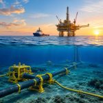
Before a platform is installed, a pipeline is laid, or a subsea cable reaches the seabed, engineers need reliable answers about the soil beneath the water. That is where Geotechnical Site Investigation Nigeria services become essential. By combining offshore sampling, in-situ testing, and laboratory analysis, these investigations help project teams understand seabed conditions before construction begins.
For developers, EPC contractors, and energy operators working across the Gulf of Guinea, partnering with an experienced provider of Geotechnical ground investigations is one of the most effective ways to reduce engineering uncertainty, avoid costly redesigns, and improve long-term asset performance.
Why Offshore Projects Depend on Geotechnical Investigations
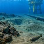
A seabed may appear uniform on a bathymetric chart, but conditions beneath the surface often tell a different story.
Across Nigeria’s offshore environment, particularly within the Niger Delta, soil conditions can change significantly over relatively short distances. Soft marine clays, loose sediments, buried channels, shallow gas pockets, and uneven soil strength all influence how offshore structures behave over time.
If these conditions are not identified early, project teams may face unexpected challenges during construction, including:
- Foundation settlement
- Pipeline instability
- Anchor holding issues
- Installation delays
- Higher construction costs
The earlier these risks are understood, the easier and less expensive they are to manage.
What Does a Geotechnical Site Investigation Involve?
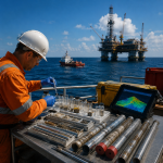
A professional Geotechnical Site Investigation program goes far beyond collecting soil samples. The objective is to understand how the seabed will respond when it supports heavy offshore infrastructure throughout its operational life.
Depending on project requirements, investigations may include the following:
- Offshore boreholes
- Cone Penetration Testing (CPT)
- Piezocone Testing (PCPT)
- Vibrocore sampling
- Laboratory soil testing
- Soil classification and strength analysis
Each dataset contributes to a clearer understanding of the site’s engineering characteristics, allowing designers to make informed decisions rather than relying on assumptions.
Why Geotechnical Ground Investigations Matter During Design
Good engineering starts long before construction vessels arrive offshore. During Front-End Engineering Design (FEED), engineers use geotechnical information to determine how foundations, anchors, and pipelines should be designed for actual seabed conditions, rather than an estimated average.
For example, an FPSO mooring system requires accurate information about soil strength before anchor locations are finalised. Similarly, subsea manifolds and pipeline supports depend on reliable bearing capacity calculations to maintain long-term stability.
Without accurate Geotechnical ground investigations, engineers often compensate by making designs more conservative. While this reduces uncertainty, it can also increase material quantities, installation complexity, and overall project costs.
Reliable site data helps achieve the right balance between safety, performance, and cost.
A Practical Example
Imagine an operator planning to install a subsea pipeline across a proposed route. Initial mapping shows no obvious obstacles, and the alignment appears suitable.
However, a geotechnical investigation identifies a section of very soft clay with poor load-bearing capacity midway along the corridor.
Instead of discovering the issue after offshore construction has started, engineers adjust the route during the design stage. That single change helps avoid additional vessel time, redesign work, and construction delays.
In offshore projects, decisions made before installation often have the greatest impact on project cost and schedule.
Supporting Compliance and Better Engineering Decisions
Technical accuracy is only part of the equation. Offshore developments in Nigeria must also satisfy regulatory requirements while meeting international engineering standards.
Geotechnical investigations provide important information used during environmental assessments, engineering design reviews, and project approvals. They also support documentation required throughout the development lifecycle.
For operators working under the requirements of the Nigerian Upstream Petroleum Regulatory Commission (NUPRC), reliable site investigation data helps strengthen engineering submissions and supports safer project execution.
Why Local Experience Makes a Difference
Modern survey equipment can collect large volumes of data, but interpreting that information correctly requires experience.
Nigeria’s offshore environment presents unique geological conditions shaped by decades of sediment deposition from the Niger Delta. Soil behaviour here can differ considerably from other offshore regions.
An experienced survey team understands where additional testing may be required, how local geology influences engineering design, and how to integrate geotechnical findings with hydrographic and geophysical survey results.
That combination of local knowledge and technical capability helps deliver information that engineers can use with confidence.
Why Choose GEMS Nigeria?
GEMS Nigeria provides integrated offshore survey solutions that support every stage of marine and energy infrastructure development.
Our capabilities include:
- Geotechnical investigations
- Hydrographic surveys
- Marine geophysical surveys
- Environmental studies
- Metocean measurements
- Seabed and site investigations
Rather than delivering isolated datasets, we help clients build a complete understanding of offshore conditions, enabling better engineering decisions from planning through construction.
Frequently Asked Questions
What is a geotechnical site investigation?
A geotechnical site investigation evaluates seabed or ground conditions through sampling, in situ testing, and laboratory analysis. The results help engineers design safe and reliable foundations for offshore and onshore infrastructure.
Why are Geotechnical ground investigations important?
They identify soil strength, settlement characteristics, and potential geohazards before construction begins, reducing engineering risk and helping optimise foundation design.
Which offshore projects require geotechnical investigations?
They are commonly used for offshore platforms, FPSOs, subsea pipelines, cables, ports, jetties, offshore wind developments, and marine infrastructure projects.
Why choose GEMS Nigeria?
GEMS Nigeria combines advanced survey technologies with extensive experience across Nigeria’s offshore sector, providing integrated geotechnical, hydrographic, geophysical, and environmental survey services that support informed engineering decisions.
Conclusion
Every successful offshore project is built on reliable information gathered before construction begins. While vessels, equipment, and engineering expertise are all essential, none of them can compensate for an incomplete understanding of ground conditions.
A professionally executed Geotechnical Site Investigation Nigeria programme gives project teams the confidence to design foundations, pipelines, and offshore structures based on measured data rather than assumptions. Combined with comprehensive Geotechnical ground investigations, it helps reduce project risk, improve construction efficiency, and support safer long-term operations.
At GEMS Nigeria, we provide the technical insight that enables developers, engineers, and operators to make informed decisions from the seabed upward.