Every offshore site has a history before the first vessel arrives. The water might carry natural hydrocarbons or trace metals. The seabed may hold contaminants that have built up over decades. And marine life in the area may depend on habitats that construction activities could disturb.
Environmental Baseline Surveys for Offshore Projects record these conditions before drilling, dredging, pipeline installation, or other marine work begins. The result is a reference point. When conditions change later, project teams can compare them against what was recorded before operations started.
What Does an Environmental Baseline Survey Cover?
It depends on the project, location, and planned work. Still, most surveys look at four main areas.
Seawater Quality
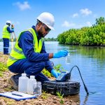
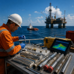
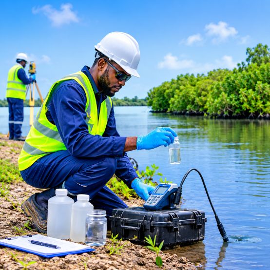
Water sampling shows the current physical and chemical condition of the water column. Typical parameters include temperature, salinity, dissolved oxygen, turbidity, and nutrients. Where relevant, teams also test for total petroleum hydrocarbons and trace metals.
CTD instruments and water-sampling rosettes collect this data at different depths. That matters offshore because surface conditions can look very different from those in the water just above the seabed.
Sediment Conditions
Seabed sediments can retain contaminants, offering useful information about what has happened in an area over time. Crews collect samples using grab samplers and box corers.
Laboratory analysis usually covers particle size, total organic carbon, and selected contaminants such as heavy metals and hydrocarbons. These results are particularly important before dredging, anchoring, or construction work that will disturb the seabed.
Marine Life and Benthic Ecology
The survey also examines what lives in and around the project area. Depending on the site, this can include plankton, benthic organisms, fish, and sensitive marine habitats.
The aim is to identify ecological features that could be affected by seabed disturbance, underwater noise, or changes in water quality.
Metocean Conditions
Currents, waves, and tides influence how sediment and other materials move around a site. Acoustic Doppler Current Profilers (ADCPs) and wave-measuring equipment help record these conditions.
These measurements also help when selecting survey windows, planning construction, and setting up environmental monitoring.
Why Carry Out Surveys Early?
The value of a baseline survey becomes clearer once offshore work begins.
Take a pipeline installation. Suppose suspended sediment levels rise during construction. Is this the result of the work, or was the water already that cloudy? Without measurements from before operations began, it becomes difficult to make that distinction.
The same applies to water quality and marine ecology. A survey completed before construction gives project teams something to compare later monitoring results against.
Carrying out the work during planning or FEED also gives engineers and environmental specialists time to examine sensitive areas and, if needed, adjust the layout or construction method before work begins.
Environmental Baseline Surveys in Nigerian Offshore Waters
Nigeria’s offshore environment is not uniform. It ranges from the shallow waters of the Niger Delta to deeper areas of the Gulf of Guinea. Sediment types, water depths, currents, and marine habitats vary across these locations.
A survey designed for one site will not automatically suit another. The scope needs to reflect the actual project area and the activities planned there.
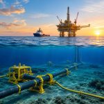
This applies to offshore platforms, subsea pipelines, cable routes, dredging, and marine terminals. Each type of development has different environmental considerations, so the survey scope should reflect the work involved.
Planning an Effective Baseline Survey
Start with the work itself. Location, water depth, seabed conditions, and construction methods all influence which samples and measurements are needed.
Environmental investigations can also run alongside hydrographic, geophysical, and geotechnical surveys. Where practical, combining these activities gives project teams a fuller picture of the site and can avoid separate mobilizations for related fieldwork.
There is no need to collect every possible type of data. The focus should be on gathering enough information to understand the site and assess the likely effects of the planned development.
Environmental Survey Support from GEMS Nigeria
GEMS Nigeria provides marine survey and geoscience services for offshore and coastal projects. Its work covers hydrographic, geophysical, geotechnical, geochemical, and environmental investigations.
When a project requires environmental baseline data, these disciplines can be scoped together where appropriate. This allows teams to review environmental findings alongside seabed, subsurface, and water-depth information during project planning.
Frequently Asked Questions
What is the main purpose of an environmental baseline survey?
It records existing environmental conditions before project activities begin. Later, conditions during and after construction or operations can be compared against that record.
How is an environmental survey different from a geophysical survey?
An environmental survey examines water quality, sediments, and marine ecosystems. A geophysical survey investigates the seabed and subsurface, identifying features such as sediment layers, buried objects, and potential geological hazards.
When should an offshore baseline survey be conducted?
It is usually carried out during early planning or the FEED stage, before construction or other activities change the existing conditions.
Understand the Site Before Work Begins
Offshore development is not only about the seabed and engineering requirements. Teams also need to understand the conditions in the surrounding marine environment before work starts.
A properly scoped baseline survey provides that starting picture. For offshore projects in Nigeria, it supports early planning, clarifies site conditions, and establishes a reference for the environmental monitoring that follows.