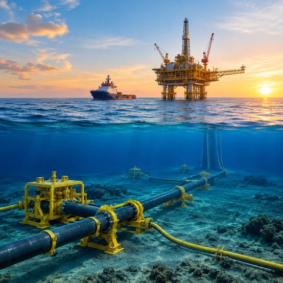
Nigeria’s offshore activity is becoming more complex. New pipelines, subsea cables, manifolds, offshore facilities, port developments, and marine connections are being planned in areas where seabed conditions can change considerably over relatively short distances.
That makes Nigeria’s subsea infrastructure development closely tied to something that is often less visible than the infrastructure itself: the quality of information available about the seabed and shallow subsurface.
A pipeline route may look straightforward on a chart. A cable corridor may appear clear. A proposed foundation location may seem suitable. Once detailed surveys begin, however, the picture can be very different.
What Makes the Nigerian Offshore Seabed Challenging?
The offshore environment around the Niger Delta has been shaped by large volumes of sediment over long periods. As a result, seabed and shallow subsurface conditions are not necessarily uniform across a project area.
Soft, weak sediments can affect how a foundation or subsea structure behaves. Changes in seabed level can create problems for pipeline support. Slopes may require closer examination before installing anchors or infrastructure. In some locations, shallow gas or buried features may also need to be investigated before construction.
Scour is another consideration. Where currents remove sediment around a structure or pipeline touchdown point, support conditions can change after installation.
None of these issues should automatically be treated as a project failure. The real problem is finding them late.
That is why site investigation needs to start with the actual conditions at the proposed location rather than assumptions based on older charts or nearby projects.
Multi-Sensor Surveys Give Engineers the Full Picture
A subsea investigation usually involves several survey disciplines because each one answers a different question.
Hydrographic Survey
Multibeam echosounder (MBES) surveys provide detailed bathymetry and show how the seabed rises, falls, slopes, and changes across the project area.
For a pipeline or cable route, this can reveal channels, depressions, steep sections, seabed irregularities, and other features that may influence routing or installation.
The important point is not simply producing a bathymetric map. Engineers need to understand what those seabed features mean for the proposed asset.
Geophysical Survey
Side-scan sonar, sub-bottom profiling, and marine magnetometer surveys take the investigation further.
Side-scan sonar can reveal debris, boulders, seabed disturbances, and other surface features. Sub-bottom profiling helps investigate sediment layers and shallow buried features. Magnetometer data can help locate ferrous objects or magnetic anomalies.
Together, these methods can highlight areas that deserve closer attention before construction equipment reaches the site.
Geotechnical Investigation
At some stage, survey interpretation needs to be backed up by physical evidence.
CPT and coring investigations provide information about soil strength, density, layering, and other characteristics relevant to foundations, anchors, pipelines, and cable installation.
For example, a seabed may appear relatively flat and suitable from a bathymetric perspective, while the soil beneath it may tell a different story.
That is why hydrographic, geophysical, and geotechnical work should not be viewed as separate exercises. Each completes the same engineering picture.
Metocean and Environmental Surveys
Waves, currents, tides, and other environmental conditions also affect offshore work.
Metocean measurements can help with vessel planning, installation windows, and understanding the conditions an offshore asset may experience during operation. Environmental information is also relevant when construction activities interact with the surrounding marine environment.
Subsea Development Is Not Limited to Oil and Gas
Oil and gas remains a major driver of subsea activity in Nigeria, but it is not the only one.
Telecommunications and power cables are creating their own route investigation requirements. A cable route can encounter existing infrastructure, debris, fishing activity, anchor interaction, mobile sediments, or other seabed constraints.
Ports and coastal developments present a different set of challenges. Dredging, breakwaters, jetties, terminals, and other marine structures depend on knowing both the seabed profile and the ground conditions beneath it.
There is also the issue of existing infrastructure.
A new pipeline or cable does not always get an empty corridor. It may need to cross or work close to existing pipelines, cables, wells, or other subsea assets. Accurate positioning and detailed seabed investigation become particularly important in these areas.
Why Early Investigation Can Save a Project From Late Changes
One of the practical benefits of carrying out detailed surveys early is that difficult findings can be dealt with while the design is still flexible.
Suppose a proposed route crosses an area with unsuitable soil conditions. If that is discovered during early engineering, the route can be reviewed.
If the same issue is discovered after mobilisation, the options become much less convenient. Engineering changes may affect schedules, installation methods, vessel requirements, or other parts of the project.
The same applies to foundation locations, cable burial, pipeline crossings, and dredging areas.
Survey work, therefore, should not be treated simply as a box to tick before construction. Its findings can influence decisions much earlier, including feasibility studies and FEED.
GEMS Nigeria and Subsea Site Investigation
GEMS Nigeria supports offshore, nearshore, and coastal projects through marine survey and geoscience services covering hydrographic, geophysical, geotechnical, geochemical, and metocean investigations.
For subsea infrastructure projects, the requirement is rarely just “collect survey data.” The investigation needs to answer specific questions about the proposed route, structure, seabed, subsurface, and surrounding environment.
That could mean detailed bathymetry for a pipeline corridor, geophysical investigation around an existing asset crossing, geotechnical work for a proposed foundation, or a combination of disciplines across a larger development area.
The survey program should follow the engineering problem rather than forcing every project into the same investigation template.
FAQs
Q. What does Nigeria’s subsea infrastructure development include?
It covers subsea pipelines, cables, offshore structures, manifolds, marine connections, and infrastructure associated with offshore energy, telecommunications, ports, and other marine developments.
Q. Why are multiple survey methods used offshore?
Because no single method can describe everything engineers need to know. Bathymetry shows seabed shape, geophysical surveys investigate surface and shallow subsurface features, while geotechnical work provides direct information about the soil.
Q. How can surveys help with existing subsea infrastructure?
Detailed seabed mapping and positioning can help identify existing assets and define crossing or construction areas before new infrastructure is installed.
Q. When should a subsea survey be carried out?
Ideally, survey planning should begin during the early project stages. Early findings can influence route selection, engineering design, construction methods, and the need for further investigation.
A Better Starting Point for Subsea Projects
Subsea infrastructure eventually becomes pipelines, cables, foundations, and offshore structures. Before any of those are installed, however, there is a less visible stage where many important decisions are made.
It starts with understanding the site.
For Nigeria’s growing offshore and marine projects, combining hydrographic, geophysical, geotechnical, and metocean information gives engineers a much clearer basis for deciding where and how infrastructure should be installed.
That is where a well-planned marine site investigation earns its place in the project: before construction begins, when there is still time to act on what the seabed is telling you.