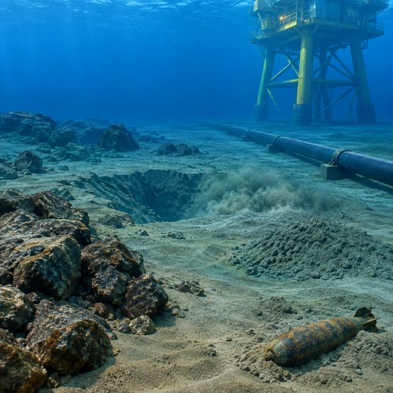
Offshore construction leaves little room for unexpected subsurface conditions. Whether a project involves subsea power cables, control umbilicals, telecommunications cables, pipelines, or offshore structures, the condition of the seabed can influence routing, installation methods, equipment selection, and long-term asset performance.
Identifying seabed risks offshore construction projects may face before installation begins allows engineering teams to address potential problems while route changes are still practical. In Nigerian waters, a detailed subsea cable survey Nigeria programme can provide the information needed to understand seabed conditions, identify hazards, and develop a route that is suitable for installation.
The Dynamic Ocean Floor: Understanding Seabed Risks
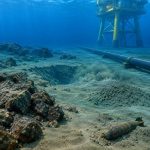
The seabed along Nigeria’s coastline and offshore areas is not a uniform surface. Sediment deposition, erosion, currents, slope conditions, and previous offshore activity can create significant variations over relatively short distances.
A route that appears straightforward on a regional chart may contain local features that matter during construction. Common seabed risks include:
- Mobile sediments and sand waves: Changes in seabed elevation can affect cable exposure, burial depth, and support conditions.
- Slope instability: Steep or unstable areas can present challenges for cable installation and other subsea infrastructure.
- Scour and seabed depressions: Localised erosion can affect pipelines, cables, foundations, and crossing points.
- Uncharted obstructions: Debris, abandoned equipment, wrecks, boulders, or existing infrastructure can interfere with installation.
- Shallow gas: Gas-bearing sediments may create additional hazards where seabed penetration or other intrusive work is planned.
- Existing subsea infrastructure: Pipelines and cables need to be identified accurately to plan safe crossings and maintain required separation.
Finding these conditions after installation has started can mean route changes, additional survey work, vessel delays, or modifications to the installation approach.
The Strategic Role of a Subsea Cable Survey in Nigeria
The subsea cable survey Nigeria program is not simply about producing a seabed map. Its purpose is to give the project team enough information to select, assess, and refine a workable route.
For a proposed cable corridor, the survey can help determine:
- Cable alignment: Identify seabed features, slopes, obstructions, and other constraints that could influence the route.
- Burial feasibility: Assess seabed and soil conditions that may affect planned burial methods and protection requirements.
- Infrastructure crossings: Locate existing pipelines and cables so crossing points can be properly engineered.
- Nearshore approach: Investigate the transition from offshore waters toward the landfall area, where seabed conditions can change quickly.
- Route optimisation: Compare alternatives before mobilisation and reduce the likelihood of making expensive changes offshore.
The earlier this information is available, the more options the engineering team has.
The Technology Suite: Building a Clearer Seabed Picture
No single survey sensor can answer every question about the seabed. A properly designed investigation combines different techniques depending on the project objectives, water depth, geology, and route conditions.
Multibeam Echo Sounder (MBES):
MBES provides high-density bathymetric coverage of the seabed. It helps identify changes in elevation, slopes, channels, depressions, and other terrain features that may influence cable or pipeline routing.
Side Scan Sonar (SSS):
SSS produces detailed acoustic imagery of the seabed surface. It is particularly useful for identifying obstructions, debris, rock features, seabed disturbances, and other objects that may not be obvious from bathymetry alone.
Sub-Bottom Profiler (SBP): SBP looks beneath the seabed surface to reveal shallow subsurface layers and buried features. The information can help identify changes in sediment conditions, buried channels, and other subsurface characteristics relevant to route planning.
Marine Magnetometer:
Magnetometer surveys help detect magnetic anomalies associated with ferrous objects. This can be useful when investigating potential buried metallic infrastructure, debris, or other targets along a proposed route.
Geotechnical Investigation:
Methods such as Cone Penetration Testing (CPT) and coring provide direct information about seabed and soil properties. These findings help engineers understand factors such as soil strength and sediment characteristics that may influence burial, trenching, anchoring, or other installation activities.
The strength of the survey comes from combining these datasets. Bathymetry shows the seabed shape, acoustic imaging highlights surface features, sub-bottom data provides information below the surface, and geotechnical investigation helps verify the physical properties of the seabed. Together, they provide a more useful basis for engineering decisions.
Why Local Expertise Matters in Nigerian Waters
Survey technology is only part of the equation. Offshore work in Nigeria also involves existing oil and gas infrastructure, vessel traffic, changing marine conditions, and the geological characteristics of the Niger Delta and surrounding waters.
Local project knowledge can help survey teams plan fieldwork around these practical considerations and interpret findings in their proper context.
For project owners and contractors, this can translate into:
- Better identification of route constraints before installation.
- More informed decisions about survey coverage and investigation methods.
- Improved coordination around existing offshore infrastructure.
- More practical planning for vessel mobilisation and field operations.
- Technical documentation that supports engineering and project requirements.
The objective is not to collect the maximum amount of data. It is to collect the right data for the decisions the project needs to make.
What Early Site Investigation Changes on a Project
Consider a subsea cable route where an initial desktop assessment suggests a relatively straightforward alignment.
During a detailed survey, the investigation identifies a combination of seabed irregularities, an area of mobile sediment, and existing subsea infrastructure close to the proposed route.
Without that information, these constraints may only become apparent during installation. The project team could then face additional investigation, route adjustments, or changes to the installation plan while an expensive offshore spread is already mobilised.
With the survey completed during the design stage, the route can be refined before installation begins. Crossing locations can be assessed, difficult seabed sections can be reviewed, and the installation methodology can be adjusted where necessary.
That is the practical value of early site investigation: it moves difficult decisions from the offshore construction phase back into the design phase, where they are generally easier to manage.
Why GEMS Nigeria?
GEMS Nigeria brings together marine survey disciplines, including hydrographic, geophysical, geotechnical, and related site investigation services, to support offshore development and infrastructure projects.
For seabed and cable-route investigations, this integrated approach allows different sources of information to be considered together. Bathymetric data can be assessed alongside acoustic imagery, subsurface profiles, and geotechnical findings to develop a clearer understanding of the proposed corridor.
For projects in Nigerian waters, that information can support decisions around route selection, crossings, installation planning, and seabed-related risks before offshore construction begins.
Frequently Asked Questions
Q. What are the main seabed risks offshore construction projects face?
Common risks include weak or variable soils, steep slopes, mobile sediments, scour, seabed depressions, shallow gas, obstructions, and unidentified existing subsea infrastructure.
Q. Why is a subsea cable survey in Nigeria important before installation?
It helps establish seabed conditions along the proposed route, identify potential hazards, assess burial and installation considerations, and locate existing infrastructure that may affect cable routing.
Q. How do geophysical and geotechnical surveys work together?
Geophysical methods such as MBES, SSS, and SBP provide broad information about seabed and shallow subsurface conditions. Geotechnical methods such as CPT and coring provide direct information about soil properties. Together, they give engineers a more complete basis for planning.
Q. Can early seabed surveys reduce offshore project costs?
They can help reduce avoidable costs by identifying route constraints and potential installation problems before vessels and equipment are mobilised. Early findings also give project teams more time to evaluate alternatives.
Build Your Offshore Project on Better Site Information
Offshore construction decisions are easier to manage when the seabed has been investigated before installation begins. A well-planned survey can identify constraints, improve route selection, and give engineering teams a clearer basis for planning subsea work.
For projects requiring seabed risks offshore construction assessment, or a subsea cable survey, GEMS Nigeria can support the investigation with integrated marine survey and site-characterisation capabilities.