When offshore infrastructure projects are planned, most attention goes to the visible outcome: a subsea cable connecting two locations, a new offshore facility, or a marine energy installation. What often receives less attention is the investigation that happens long before construction begins. Seabed mapping services provide the information engineers need to understand what lies beneath the water, while a detailed cable route investigation helps determine the safest, most practical path before installation vessels ever leave port.
At GEMS Nigeria, we’ve seen how early survey decisions influence everything that follows. A route that appears straightforward on existing charts can reveal unexpected seabed conditions once modern survey equipment begins collecting data. Identifying those conditions before construction is one of the most effective ways to reduce technical risk, control project costs, and avoid unnecessary delays.
Why Existing Charts Are Rarely Enough
Marine environments rarely remain unchanged.
Strong currents, sediment movement, seasonal weather patterns, vessel traffic, and previous offshore activities continually reshape sections of the seabed. Areas that looked suitable during an earlier survey may no longer present the same conditions today.
For project owners, this creates an important question:
“Are we designing around current seabed conditions or outdated assumptions?”
That distinction matters.
Even a relatively short cable corridor can pass through multiple soil types, buried objects, uneven seabed slopes, or existing offshore infrastructure. Missing one of these conditions can lead to expensive redesigns once installation has already started.
This is why comprehensive seabed mapping services have become a standard part of offshore project planning rather than an optional exercise.
What Seabed Mapping Actually Involves
Many people assume seabed mapping simply measures water depth.
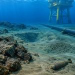
In reality, it provides a much broader understanding of both the seabed surface and the shallow layers beneath it.
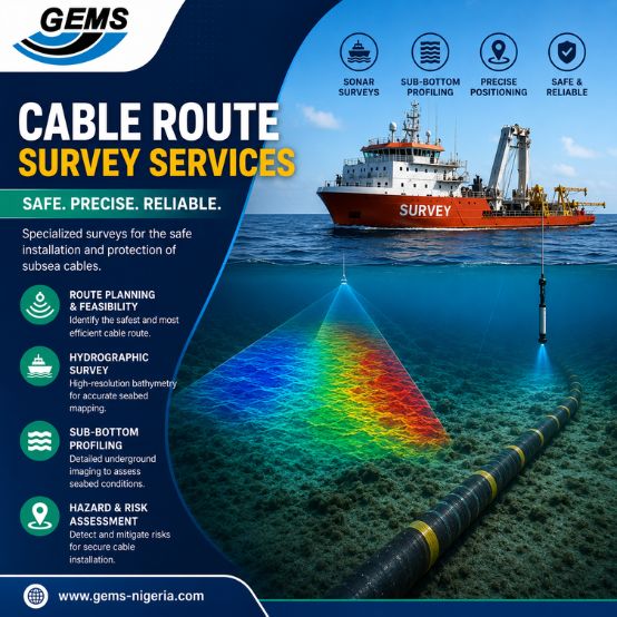
Depending on project requirements, survey teams may combine several complementary technologies, including:
- Multi-Beam Echo Sounders (MBES) for detailed bathymetric mapping
- Side Scan Sonar (SSS) to identify debris, exposed pipelines, wrecks, and seabed features
- Sub-Bottom Profilers (SBP) to investigate sediment layers beneath the seabed
- Magnetometers to locate buried metallic objects or existing subsea assets
- Cone Penetration Testing (CPT) and soil sampling, where geotechnical verification is required
Each dataset contributes to a clearer understanding of site conditions. Instead of relying on isolated measurements, engineers receive a detailed picture that supports safer design decisions.
Why Cable Route Investigation Is About More Than Finding the Shortest Path
One of the biggest misconceptions in offshore development is that the shortest route is automatically the best one.
In practice, route selection is a balance between engineering, environmental, operational, and commercial considerations.
A professional cable route investigation evaluates factors such as the following:
- Seabed gradients
- Sediment stability
- Burial feasibility
- Existing pipelines and subsea infrastructure
- Geological hazards
- Shipping activity
- Fishing zones
- Environmental restrictions
- Long-term maintenance access
Sometimes moving a proposed route by only a few hundred meters can significantly reduce installation complexity and improve long-term asset reliability.
Those decisions are much easier and far less expensive to make before construction begins.
Local Experience Makes Better Decisions
Technology plays an important role, but experience interpreting the data matters just as much.
Nigeria’s offshore environment presents conditions that differ from many other parts of the world. The Niger Delta introduces high sediment loads into coastal waters, while parts of the continental shelf contain soft clays, buried channels, shallow gas pockets, and rapidly changing seabed morphology.
These local characteristics influence how cables are designed, buried, and protected.
Survey teams familiar with these regional conditions can identify patterns that may not be obvious from raw datasets alone, allowing engineers to make decisions based on practical field experience as well as technical measurements.
Where These Surveys Add Value
Cable route investigations now support far more than traditional telecommunications projects.
Across Nigeria and the wider Gulf of Guinea, accurate seabed information is increasingly important for the following:
Oil and Gas
Power and communication cables connecting offshore platforms, subsea production systems, and floating facilities require carefully selected routes that minimise exposure to hazards.
Telecommunications
International fiber-optic cables carry enormous volumes of digital traffic into West Africa. Careful route planning helps protect these critical assets from anchors, fishing activity, and seabed instability.
Renewable Energy
As offshore renewable projects expand globally, reliable seabed data helps determine suitable locations for export cables and supporting infrastructure.
Ports and Coastal Infrastructure
Harbour developments, dredging programs, coastal protection works, and marine transportation projects all rely on accurate seabed information before construction begins.
Although the applications differ, the objective remains the same: understand the site before committing to a major investment.
A Small Survey Often Prevents Much Bigger Problems
One offshore contractor recently described marine surveys as “the cheapest insurance you’ll buy on a major project.”
That observation reflects reality.
Compared with vessel mobilisation, offshore construction, or emergency repair campaigns, the cost of a detailed survey is relatively small. Yet the information it provides frequently prevents issues that could affect budgets, schedules, or long-term asset performance.
Reliable survey data allows engineering teams to solve problems while they’re still drawing on a screen rather than facing expensive challenges at sea.
That shift from reacting to anticipating is where much of the project’s value is created.
Why GEMS Nigeria
At GEMS Nigeria, marine surveys are approached as engineering investigations rather than simple data collection exercises.
Our teams combine advanced hydrographic, geophysical, and geotechnical technologies with practical offshore experience gained across Nigerian and West African waters. Every project is planned around the client’s engineering objectives, ensuring that collected data supports real-world decision-making rather than simply generating reports.
Whether supporting offshore energy developments, subsea telecommunications, marine infrastructure, or coastal engineering projects, our focus remains the same: delivering reliable information that helps clients reduce uncertainty before construction begins.
Frequently Asked Questions
What are seabed mapping services?
Seabed mapping services use hydrographic, geophysical, and geotechnical survey techniques to create accurate information about seabed topography, sediment conditions, underwater hazards, and shallow subsurface features before offshore development.
Why is a cable route investigation important?
A Cable Route Investigation helps engineers identify the safest and most practical alignment for subsea cables by assessing seabed conditions, existing infrastructure, geological hazards, burial conditions, and environmental constraints.
Which industries benefit from these surveys?
Oil and gas, offshore renewable energy, telecommunications, marine construction, dredging, ports, coastal infrastructure, and subsea utility projects all depend on accurate seabed investigations.
How often should seabed mapping be repeated?
It depends on the project and local seabed conditions. Areas with active sediment movement, heavy marine traffic, or ongoing offshore operations often require repeat surveys throughout an asset’s lifecycle.
Final Thoughts
Offshore projects succeed long before construction starts. They succeed when decisions are based on reliable information rather than assumptions.
Professional seabed mapping services and a thorough cable route investigation provide that confidence. By understanding seabed conditions early, project teams can reduce uncertainty, improve installation efficiency, and protect critical offshore assets throughout their operational life.
For organisations planning marine infrastructure across Nigeria and West Africa, investing in accurate site investigations isn’t simply another project stage, it is one of the smartest decisions made before the first cable is ever laid.